
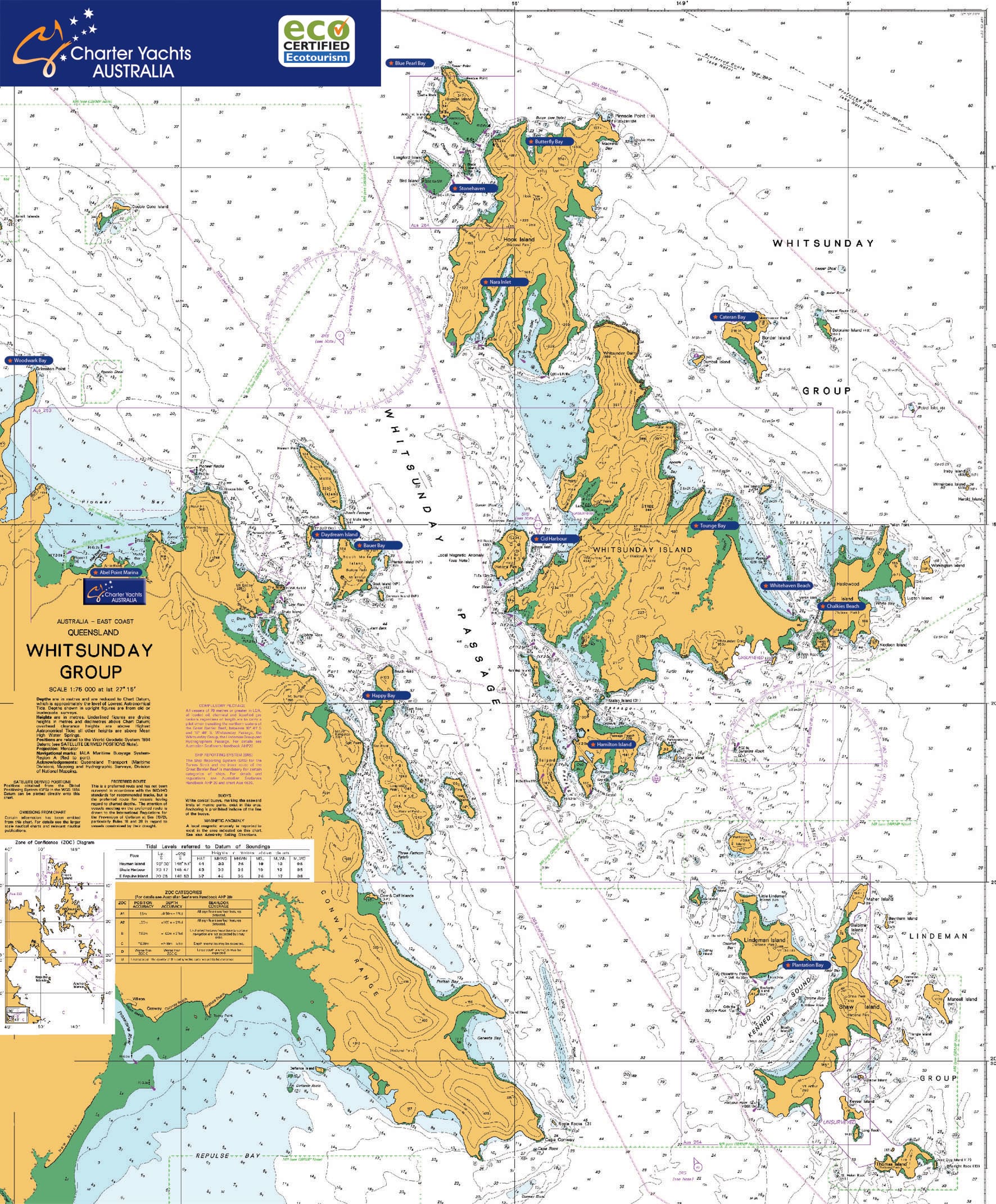
The Whitsundays are a group of 74 islands located in tropical North Queensland that are sheltered behind the Great Barrier Reef creating ideal conditions for sailing.
The map below may be a useful tool to start planning for your Whitsunday sailing holiday of a lifetime. For more detailed information regarding suggested itineraries and approved anchorages, please click the on the links under the map.
Click the map for a larger view.
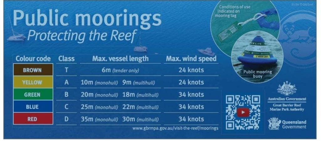
Public Moorings and Responsible Anchoring in the Great Barrier Reef
Heading out boating? All you need to know to utilise the system of public moorings in the Great Barrier Reef and help protect delicate coral from anchor damage.
The Great Barrier Reef and its spectacular island national parks are home to an abundant and diverse marine life, attracting thousands of visitors each year.
The magnificent corals are among the most popular attractions, yet they are the most vulnerable. Coral reefs can be damaged by:
• a vessel’s anchor and chain dropping or dragging on coral;
• a vessel grounding when the wind changes or the tide ebbs; and
• a chain or rope wrapping around coral and breaking pieces off.
Coral can be killed or damaged by anchoring. It may take many years for the coral to recover. Some coral never returns to its original condition.
Public moorings and reef protection markers have been installed in a number of locations throughout the Great Barrier Reef to reduce anchor damage.
The following is a brief overview of the public moorings throughout the Whitsunday Islands. For more information simply scan the barcode.